 Tyler Field
SF Census
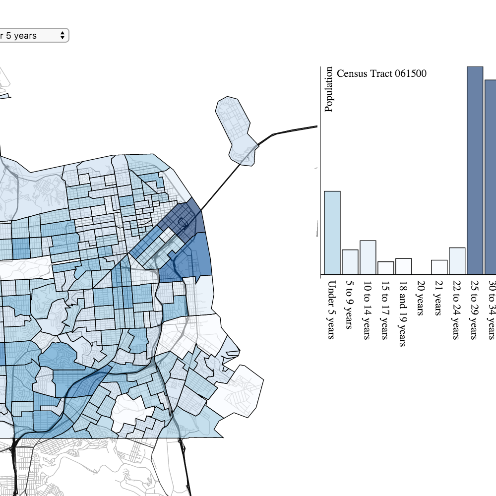
An Exploration of SF Demographic data from the US Census Bureau. The map shows the population density of a selected demographic group, while the bar chart shows the population distribution for the selected census tract.
Using data from datasf.org and tiles from OpenStreetMap, I made a clickable map that shows neighborhoods in San Francisco.